
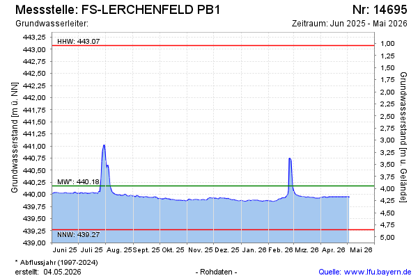
Current data FS-LERCHENFELD PB1
Groundwater level [m above sealevel]: 440.00
Distance to surface [m]: 4.12
Last value from 10.07.2026 09:00
Ground level [m above sealevel]: 444.12
| Date | Groundwater level [m above sealevel] |
|---|---|
| 09.07.2026 | 440.01 |
| 08.07.2026 | 440.01 |
| 07.07.2026 | 440.02 |
| 06.07.2026 | 440.03 |
| 05.07.2026 | 440.01 |
| 04.07.2026 | 440.02 |
| 03.07.2026 | 440.03 |
| 02.07.2026 | 440.05 |