
- Start >
- Groundwater >
- Waterlevel of upper layer >
- Isar >
- FRIEDBERG 103 >
- Chart of total period

Chart of total period FRIEDBERG 103
Groundwater levels of the total period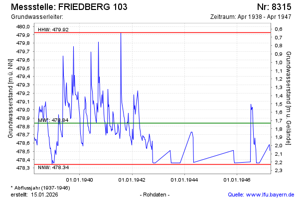
Groundwater level [m above sealevel]: 478.36
Distance to surface [m]: 2.21
Last value from 19.04.1947 12:00
Ground level [m above sealevel]: 480.57
| Date | Groundwater level [m above sealevel] |
|---|---|
| 05.04.1947 | 478.51 |
| 27.03.1947 | 478.58 |
| 09.11.1946 | 478.36 |
| 10.10.1946 | 478.36 |
| 04.10.1946 | 478.36 |
| 28.09.1946 | 478.36 |
| 21.09.1946 | 478.52 |
| 14.09.1946 | 478.56 |
© Bayerisches Landesamt für Umwelt 2026