
- Start >
- Groundwater >
- Waterlevel of upper layer >
- Isar >
- FREISING 275C >
- Chart of total period

Chart of total period FREISING 275C
Groundwater levels of the total period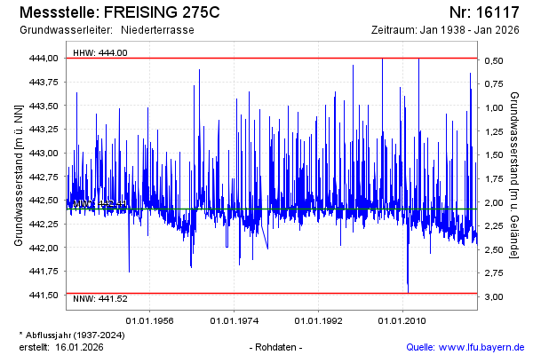
Groundwater level [m above sealevel]: 442.21
Distance to surface [m]: 2.27
Last value from 06.03.2026 10:00
Ground level [m above sealevel]: 444.48
| Date | Groundwater level [m above sealevel] |
|---|---|
| 06.03.2026 | 442.21 |
| 05.03.2026 | 442.22 |
| 04.03.2026 | 442.25 |
| 03.03.2026 | 442.29 |
| 02.03.2026 | 442.34 |
| 01.03.2026 | 442.41 |
| 28.02.2026 | 442.54 |
| 27.02.2026 | 442.72 |
© Bayerisches Landesamt für Umwelt 2026