
- Start >
- Groundwater >
- Waterlevel of upper layer >
- Isar >
- FINSTERW.-GEIGELST. 3 >
- Chart of total period

Chart of total period FINSTERW.-GEIGELST. 3
Groundwater levels of the total period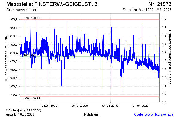
Groundwater level [m above sealevel]: 450.18
Distance to surface [m]: 1.63
Last value from 05.05.2026 11:59
Ground level [m above sealevel]: 451.81
| Date | Groundwater level [m above sealevel] |
|---|---|
| 05.05.2026 | 450.14 |
| 04.05.2026 | 450.15 |
| 03.05.2026 | 450.14 |
| 02.05.2026 | 450.17 |
| 01.05.2026 | 450.20 |
| 30.04.2026 | 450.20 |
| 29.04.2026 | 450.19 |
| 28.04.2026 | 450.16 |
© Bayerisches Landesamt für Umwelt 2026