
- Start >
- Groundwater >
- Waterlevel of upper layer >
- Isar >
- Fahrenzhausen P 6 >
- Chart of total period

Chart of total period Fahrenzhausen P 6
Groundwater levels of the total period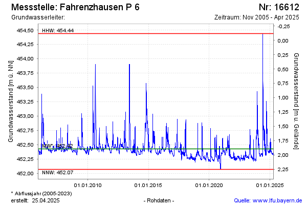
Groundwater level [m above sealevel]: 453.47
Distance to surface [m]: 0.85
Last value from 06.06.2024 10:00
Ground level [m above sealevel]: 454.32
| Date | Groundwater level [m above sealevel] |
|---|---|
| 06.06.2024 | 453.46 |
| 05.06.2024 | 453.61 |
| 04.06.2024 | 453.84 |
| 03.06.2024 | 454.19 |
| 02.06.2024 | 454.44 |
| 01.06.2024 | 453.54 |
| 31.05.2024 | 452.37 |
| 30.05.2024 | 452.32 |
© Bayerisches Landesamt für Umwelt 2024