
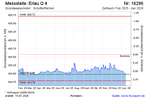
Current data Erlau Q 4
Groundwater level [m above sealevel]: 424.88
Distance to surface [m]: 0.69
Last value from 10.07.2026 10:00
Ground level [m above sealevel]: 425.57
| Date | Groundwater level [m above sealevel] |
|---|---|
| 09.07.2026 | 424.89 |
| 08.07.2026 | 424.88 |
| 07.07.2026 | 424.88 |
| 06.07.2026 | 424.89 |
| 05.07.2026 | 424.88 |
| 04.07.2026 | 424.88 |
| 03.07.2026 | 424.89 |
| 02.07.2026 | 424.92 |