
- Start >
- Groundwater >
- Waterlevel of upper layer >
- Isar >
- Erding-Siglfing >
- Current data

Current data Erding-Siglfing
Groundwater levels of the last 12 months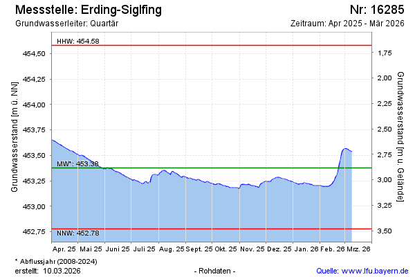
Groundwater level [m above sealevel]: 453.74
Distance to surface [m]: 2.52
Last value from 08.05.2024 09:00
Ground level [m above sealevel]: 456.26
| Date | Groundwater level [m above sealevel] |
|---|---|
| 08.05.2024 | 453.74 |
| 07.05.2024 | 453.74 |
| 06.05.2024 | 453.74 |
| 05.05.2024 | 453.74 |
| 04.05.2024 | 453.74 |
| 03.05.2024 | 453.75 |
| 02.05.2024 | 453.76 |
| 01.05.2024 | 453.77 |
© Bayerisches Landesamt für Umwelt 2024