
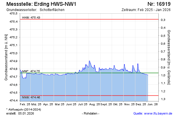
Current data Erding HWS-NW1
Groundwater level [m above sealevel]: 474.78
Distance to surface [m]: 0.94000000000005
Last value from 10.07.2026 10:00
Ground level [m above sealevel]: 475.72
| Date | Groundwater level [m above sealevel] |
|---|---|
| 09.07.2026 | 474.78 |
| 08.07.2026 | 474.78 |
| 07.07.2026 | 474.79 |
| 06.07.2026 | 474.82 |
| 05.07.2026 | 474.78 |
| 04.07.2026 | 474.77 |
| 03.07.2026 | 474.78 |
| 02.07.2026 | 474.81 |