
- Start >
- Groundwater >
- Waterlevel of upper layer >
- Isar >
- Erding HWS BSP 3 >
- Chart of total period

Chart of total period Erding HWS BSP 3
Groundwater levels of the total period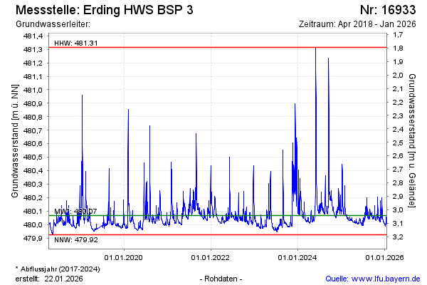
Groundwater level [m above sealevel]: 480.42
Distance to surface [m]: 2.69
Last value from 06.06.2024 09:00
Ground level [m above sealevel]: 483.11
| Date | Groundwater level [m above sealevel] |
|---|---|
| 06.06.2024 | 480.40 |
| 05.06.2024 | 480.56 |
| 04.06.2024 | 480.77 |
| 03.06.2024 | 480.94 |
| 02.06.2024 | 481.14 |
| 01.06.2024 | 481.31 |
| 31.05.2024 | 480.48 |
| 30.05.2024 | 480.20 |
© Bayerisches Landesamt für Umwelt 2024