
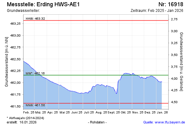
Current data Erding HWS-AE1
Groundwater level [m above sealevel]: 462.04
Distance to surface [m]: 4.05
Last value from 06.07.2026 10:00
Ground level [m above sealevel]: 466.09
| Date | Groundwater level [m above sealevel] |
|---|---|
| 06.07.2026 | 462.04 |
| 05.07.2026 | 462.01 |
| 04.07.2026 | 462.01 |
| 03.07.2026 | 462.02 |
| 02.07.2026 | 462.02 |
| 01.07.2026 | 461.95 |
| 30.06.2026 | 461.90 |
| 29.06.2026 | 461.90 |