
Chart of total period Emmerting - A3
Groundwater level [m above sealevel]: 385,41
Distance to surface [m]: 2,73
Last value from 10.03.2026 10:00
Ground level [m above sealevel]: 388.14
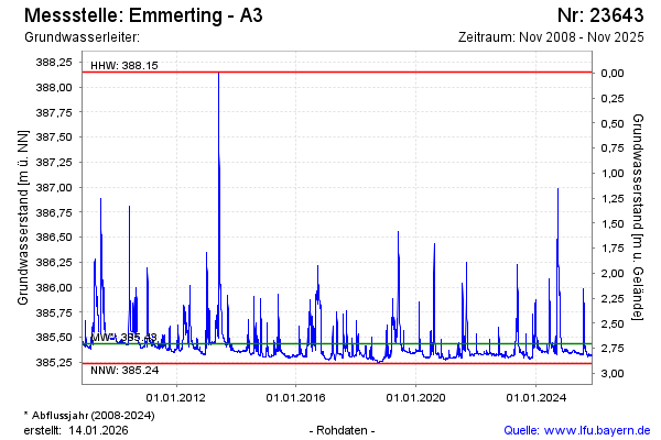
| Date | Groundwater level [m above sealevel] |
|---|---|
| 10.03.2026 | 385.40 |
| 09.03.2026 | 385.36 |
| 08.03.2026 | 385.33 |
| 07.03.2026 | 385.34 |
| 06.03.2026 | 385.34 |
| 05.03.2026 | 385.33 |
| 04.03.2026 | 385.35 |
| 03.03.2026 | 385.37 |