
Chart of total period ELSBETH / STADL 91
Groundwater level [m above sealevel]: 418,75
Distance to surface [m]: 58,06
Last value from 16.06.2026 16:07
Ground level [m above sealevel]: 476.81
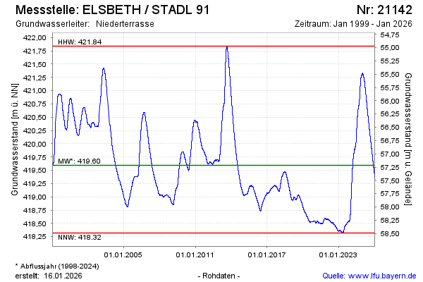
| Date | Groundwater level [m above sealevel] |
|---|---|
| 16.06.2026 | 418.75 |
| 15.06.2026 | 418.75 |
| 28.04.2026 | 418.94 |
| 20.04.2026 | 418.97 |
| 19.04.2026 | 418.98 |
| 18.04.2026 | 418.98 |
| 17.04.2026 | 418.99 |
| 16.04.2026 | 418.99 |