
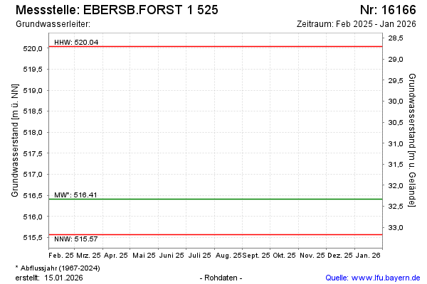
Current data EBERSB.FORST 1 525
note
Beobachtung nur mehr halbjährlich.
Groundwater level [m above sealevel]: 515.58
Distance to surface [m]: 33.16
Last value from 15.04.2026 10:33
Ground level [m above sealevel]: 548.74
| Date | Groundwater level [m above sealevel] |
|---|---|
| 14.10.2025 | 515.69 |
| 23.04.2025 | 516.41 |
| 09.10.2024 | 516.48 |
| 17.04.2024 | 516.43 |
| 18.10.2023 | 515.65 |
| 01.10.2023 | -- |
| 30.09.2023 | -- |
| 29.09.2023 | -- |