
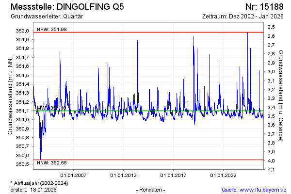
Chart of total period DINGOLFING Q5
Groundwater level [m above sealevel]: 351.03
Distance to surface [m]: 3.51
Last value from 14.07.2026 10:00
Ground level [m above sealevel]: 354.54
| Date | Groundwater level [m above sealevel] |
|---|---|
| 14.07.2026 | 351.03 |
| 13.07.2026 | 351.03 |
| 12.07.2026 | 351.03 |
| 11.07.2026 | 351.04 |
| 10.07.2026 | 351.04 |
| 09.07.2026 | 351.05 |
| 08.07.2026 | 351.05 |
| 07.07.2026 | 351.06 |