
- Start >
- Groundwater >
- Waterlevel of upper layer >
- Isar >
- DERCHING 638 A >
- Chart of total period

Chart of total period DERCHING 638 A
Groundwater levels of the total period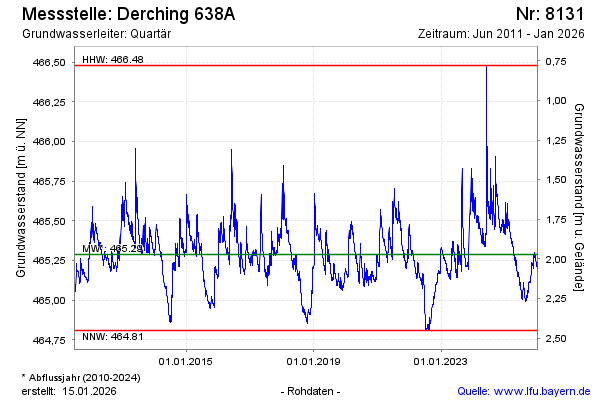
Groundwater level [m above sealevel]: 465.39
Distance to surface [m]: 1.87
Last value from 29.04.2024 09:00
Ground level [m above sealevel]: 467.26
| Date | Groundwater level [m above sealevel] |
|---|---|
| 29.04.2024 | 465.39 |
| 28.04.2024 | 465.40 |
| 27.04.2024 | 465.40 |
| 26.04.2024 | 465.41 |
| 25.04.2024 | 465.42 |
| 24.04.2024 | 465.43 |
| 23.04.2024 | 465.43 |
| 22.04.2024 | 465.44 |
© Bayerisches Landesamt für Umwelt 2024