
- Start >
- Groundwater >
- Waterlevel of upper layer >
- Isar >
- CUXHAUSEN 372A >
- Chart of total period

Chart of total period CUXHAUSEN 372A
Groundwater levels of the total period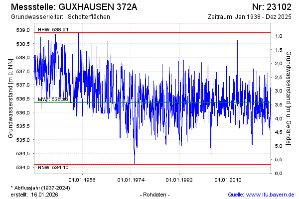
Groundwater level [m above sealevel]: 536.09
Distance to surface [m]: 3.69
Last value from 02.04.2026 09:00
Ground level [m above sealevel]: 539.78
| Date | Groundwater level [m above sealevel] |
|---|---|
| 02.04.2026 | 536.09 |
| 01.04.2026 | 536.10 |
| 31.03.2026 | 536.10 |
| 30.03.2026 | 536.11 |
| 29.03.2026 | 536.12 |
| 28.03.2026 | 536.13 |
| 27.03.2026 | 536.14 |
| 26.03.2026 | 536.15 |
© Bayerisches Landesamt für Umwelt 2026