
Chart of total period BK2-Urschlauer Ache
Groundwater level [m above sealevel]: 650,17
Distance to surface [m]: 2,42
Last value from 19.07.2026 14:21
Ground level [m above sealevel]: 652.59
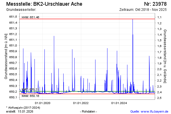
| Date | Groundwater level [m above sealevel] |
|---|---|
| 20.03.2026 | 650.17 |
| 15.11.2025 | 650.17 |
| 14.11.2025 | 650.17 |
| 13.11.2025 | 650.17 |
| 12.11.2025 | 650.17 |
| 11.11.2025 | 650.17 |
| 10.11.2025 | 650.17 |
| 09.11.2025 | 650.17 |