
- Start >
- Groundwater >
- Waterlevel of upper layer >
- Isar >
- BAD AIBLING R 28 >
- Chart of total period

Chart of total period BAD AIBLING R 28
Groundwater levels of the total period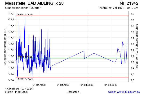
note
Die Messstelle wird nicht mehr beobachtet.
Groundwater level [m above sealevel]: 478.34
Distance to surface [m]: 3.15
Last value from 13.05.2025 00:00
Ground level [m above sealevel]: 481.49
| Date | Groundwater level [m above sealevel] |
|---|---|
| 10.10.2024 | 478.58 |
| 13.05.2024 | 478.21 |
| 11.10.2023 | 478.18 |
| 02.05.2023 | 478.47 |
| 07.10.2022 | 478.53 |
| 05.05.2022 | 478.16 |
| 07.10.2021 | 478.35 |
| 11.05.2021 | 478.37 |
© Bayerisches Landesamt für Umwelt 2026