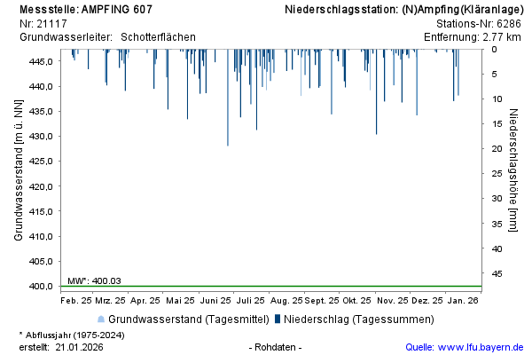
Year chart of precipitation AMPFING 607
note
Beobachtung nur mehr halbjährlich
Groundwater level [m above sealevel]: 398,50
Distance to surface [m]: 24,97
Last value from 16.04.2026 11:47
Ground level [m above sealevel]: 423.47

Beobachtung nur mehr halbjährlich
Groundwater level [m above sealevel]: 398,50
Distance to surface [m]: 24,97
Last value from 16.04.2026 11:47
Ground level [m above sealevel]: 423.47