
- Start >
- Groundwater >
- Waterlevel of upper layer >
- Isar >
- 20 KV MAST 5 >
- Chart of total period

Chart of total period 20 KV MAST 5
Groundwater levels of the total period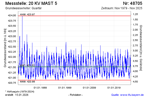
Groundwater level [m above sealevel]: 421.28
Distance to surface [m]: 4.03
Last value from 07.05.2026 08:00
Ground level [m above sealevel]: 425.31
| Date | Groundwater level [m above sealevel] |
|---|---|
| 07.05.2026 | 421.29 |
| 06.05.2026 | 421.33 |
| 05.05.2026 | 421.29 |
| 04.05.2026 | 421.24 |
| 03.05.2026 | 421.22 |
| 02.05.2026 | 421.18 |
| 01.05.2026 | 421.19 |
| 30.04.2026 | 421.22 |
© Bayerisches Landesamt für Umwelt 2026