
- Start >
- Groundwater >
- Waterlevel of upper layer >
- Inn >
- ZOLLAMT 23A >
- Chart of total period

Chart of total period ZOLLAMT 23A
Groundwater levels of the total period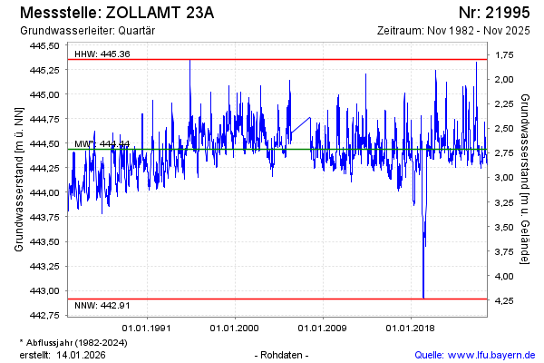
note
Die Messstelle musste 2007 verlegt werden !
Groundwater level [m above sealevel]: 444.40
Distance to surface [m]: 2.75
Last value from 07.04.2026 09:44
Ground level [m above sealevel]: 447.15
| Date | Groundwater level [m above sealevel] |
|---|---|
| 07.04.2026 | 444.39 |
| 06.04.2026 | 444.39 |
| 05.04.2026 | 444.40 |
| 04.04.2026 | 444.40 |
| 03.04.2026 | 444.41 |
| 02.04.2026 | 444.41 |
| 01.04.2026 | 444.42 |
| 31.03.2026 | 444.42 |
© Bayerisches Landesamt für Umwelt 2026