
- Start >
- Groundwater >
- Waterlevel of upper layer >
- Inn >
- Wolnzach T2 >
- Chart of total period

Chart of total period Wolnzach T2
Groundwater levels of the total period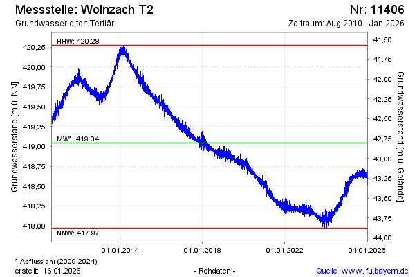
Groundwater level [m above sealevel]: 418.15
Distance to surface [m]: 43.70
Last value from 25.04.2024 10:00
Ground level [m above sealevel]: 461.85
| Date | Groundwater level [m above sealevel] |
|---|---|
| 25.04.2024 | 418.16 |
| 24.04.2024 | 418.18 |
| 23.04.2024 | 418.15 |
| 22.04.2024 | 418.12 |
| 21.04.2024 | 418.12 |
| 20.04.2024 | 418.11 |
| 19.04.2024 | 418.15 |
| 18.04.2024 | 418.10 |
© Bayerisches Landesamt für Umwelt 2024