- Start >
- Groundwater >
- Waterlevel of upper layer >
- Inn >
- WIMPASING 611A P52080 >
- Year chart of precipitation
Year chart of precipitation WIMPASING 611A P52080
Groundwater levels of the last 12 months
note
2010 Verlegung der Messstelle wegen Autobahnbau
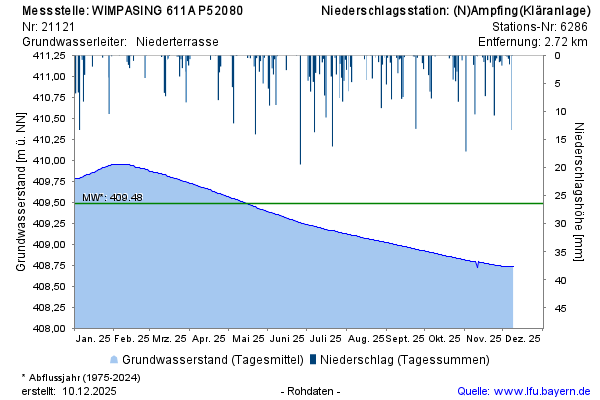
Groundwater level [m above sealevel]: 408.59
Distance to surface [m]:
Last value from 2019-11-19 12:04:29
Ground level [m above sealevel]: 421.16
No data available of the last 12 months or no measurement site for precipitation of the bavarian administration for water management availabel in close proximity.