
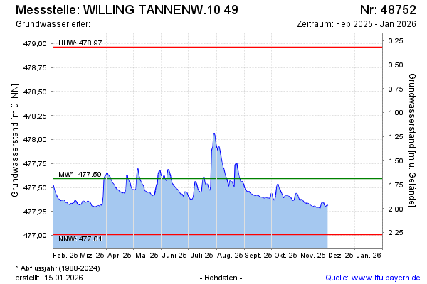
Current data WILLING TANNENW.10 49
Groundwater level [m above sealevel]: 477.34
Distance to surface [m]: 1.94
Last value from 22.06.2026 09:56
Ground level [m above sealevel]: 479.28
| Date | Groundwater level [m above sealevel] |
|---|---|
| 22.06.2026 | 477.34 |
| 21.06.2026 | 477.34 |
| 20.06.2026 | 477.35 |
| 19.06.2026 | 477.36 |
| 18.06.2026 | 477.38 |
| 17.06.2026 | 477.38 |
| 16.06.2026 | 477.42 |
| 15.06.2026 | 477.45 |