
Current data WESTERHAM R 15
Groundwater level [m above sealevel]: 548.04
Distance to surface [m]: 4.21
Last value from 24.06.2026 07:00
Ground level [m above sealevel]: 552.25
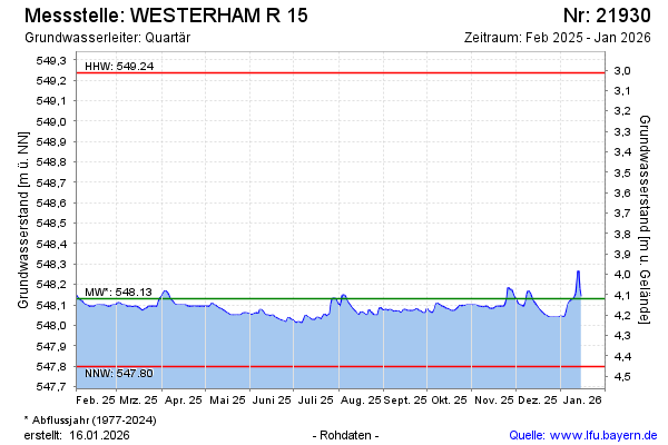
| Date | Groundwater level [m above sealevel] |
|---|---|
| 28.06.2026 | 548.03 |
| 27.06.2026 | 548.03 |
| 26.06.2026 | 548.03 |
| 25.06.2026 | 548.04 |
| 24.06.2026 | 548.04 |
| 23.06.2026 | 548.03 |
| 22.06.2026 | 548.04 |
| 21.06.2026 | 548.04 |