
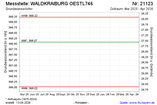
Current data WALDKRAIBURG OESTL746
note
Die Messstelle wird nicht mehr beobachtet.
Groundwater level [m above sealevel]: 397,25
Distance to surface [m]: 28,39
Last value from 16.04.2026 07:28
Ground level [m above sealevel]: 425.64
| Date | Groundwater level [m above sealevel] |
|---|---|
| 15.10.2025 | 397.75 |
| 22.04.2025 | 398.28 |
| 10.10.2024 | 398.14 |
| 16.04.2024 | 397.73 |
| 19.10.2023 | 396.84 |
| 19.04.2023 | 396.90 |
| 18.10.2022 | 396.53 |
| 11.04.2022 | 396.44 |