
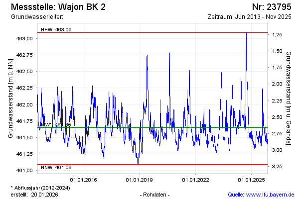
Chart of total period Wajon-BK2
Groundwater level [m above sealevel]: 461,36
Distance to surface [m]: 2,95
Last value from 13.07.2026 10:00
Ground level [m above sealevel]: 464.31
| Date | Groundwater level [m above sealevel] |
|---|---|
| 13.07.2026 | 461.36 |
| 12.07.2026 | 461.36 |
| 11.07.2026 | 461.37 |
| 10.07.2026 | 461.38 |
| 09.07.2026 | 461.40 |
| 08.07.2026 | 461.42 |
| 07.07.2026 | 461.44 |
| 06.07.2026 | 461.47 |