
- Start >
- Groundwater >
- Waterlevel of upper layer >
- Inn >
- Südl. Freising M 6 >
- Chart of total period

Chart of total period Südl. Freising M 6
Groundwater levels of the total period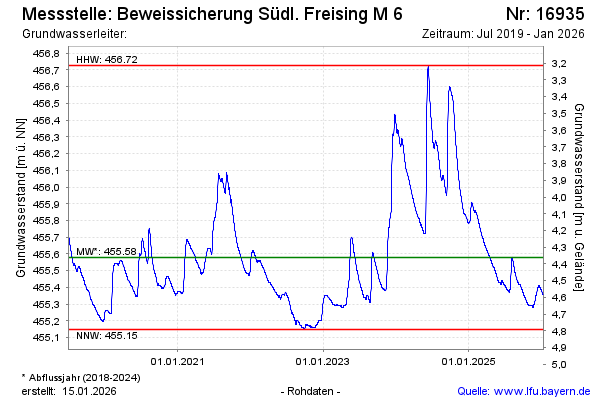
Groundwater level [m above sealevel]: 455.78
Distance to surface [m]: 4.16
Last value from 07.05.2024 09:00
Ground level [m above sealevel]: 459.94
| Date | Groundwater level [m above sealevel] |
|---|---|
| 07.05.2024 | 455.78 |
| 06.05.2024 | 455.77 |
| 05.05.2024 | 455.77 |
| 04.05.2024 | 455.78 |
| 03.05.2024 | 455.78 |
| 02.05.2024 | 455.79 |
| 01.05.2024 | 455.79 |
| 30.04.2024 | 455.80 |
© Bayerisches Landesamt für Umwelt 2024