
- Start >
- Groundwater >
- Waterlevel of upper layer >
- Inn >
- STADT KOLBERMOOR 15A >
- Chart of total period

Chart of total period STADT KOLBERMOOR 15A
Groundwater levels of the total period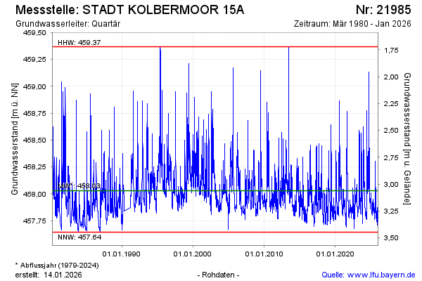
note
Die Messstelle musste 1990 verlegt werden !
Groundwater level [m above sealevel]: 457.82
Distance to surface [m]: 3.27
Last value from 27.04.2024 10:00
Ground level [m above sealevel]: 461.09
| Date | Groundwater level [m above sealevel] |
|---|---|
| 27.04.2024 | 457.82 |
| 26.04.2024 | 457.82 |
| 25.04.2024 | 457.83 |
| 24.04.2024 | 457.83 |
| 23.04.2024 | 457.82 |
| 22.04.2024 | 457.82 |
| 21.04.2024 | 457.81 |
| 20.04.2024 | 457.80 |
© Bayerisches Landesamt für Umwelt 2024