
- Start >
- Groundwater >
- Waterlevel of upper layer >
- Inn >
- Sauerlach Q 9 >
- Current data

Current data Sauerlach Q 9
Groundwater levels of the last 12 months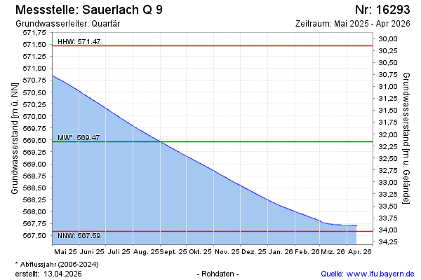
Groundwater level [m above sealevel]: 568.06
Distance to surface [m]: 33.56
Last value from 23.01.2026 09:00
Ground level [m above sealevel]: 601.62
| Date | Groundwater level [m above sealevel] |
|---|---|
| 23.01.2026 | 568.06 |
| 22.01.2026 | 568.06 |
| 21.01.2026 | 568.07 |
| 20.01.2026 | 568.08 |
| 19.01.2026 | 568.09 |
| 18.01.2026 | 568.09 |
| 17.01.2026 | 568.10 |
| 16.01.2026 | 568.11 |
© Bayerisches Landesamt für Umwelt 2026