
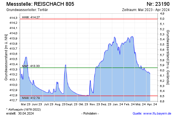
Current data REISCHACH 805
Groundwater level [m above sealevel]: 412.89
Distance to surface [m]: 6.39
Last value from 06.05.2026 10:12
Ground level [m above sealevel]: 419.28
| Date | Groundwater level [m above sealevel] |
|---|---|
| 06.05.2026 | 412.89 |
| 05.05.2026 | 412.89 |
| 04.05.2026 | 412.89 |
| 03.05.2026 | 412.90 |
| 02.05.2026 | 412.90 |
| 01.05.2026 | 412.90 |
| 30.04.2026 | 412.90 |
| 29.04.2026 | 412.90 |