
- Start >
- Groundwater >
- Waterlevel of upper layer >
- Inn >
- Raitenhaslach B20 >
- Chart of total period

Chart of total period Raitenhaslach B20
Groundwater levels of the total period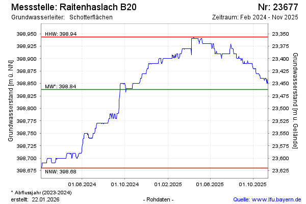
Groundwater level [m above sealevel]: 398.79
Distance to surface [m]: 23.51
Last value from 05.03.2026 13:14
Ground level [m above sealevel]: 422.30
| Date | Groundwater level [m above sealevel] |
|---|---|
| 05.03.2026 | 398.78 |
| 04.03.2026 | 398.78 |
| 03.03.2026 | 398.78 |
| 02.03.2026 | 398.78 |
| 01.03.2026 | 398.79 |
| 28.02.2026 | 398.79 |
| 27.02.2026 | 398.79 |
| 26.02.2026 | 398.79 |
© Bayerisches Landesamt für Umwelt 2026