
Current data Pötschgraben GWM1
Groundwater level [m above sealevel]: 673.30
Distance to surface [m]: 1.6500000000001
Last value from 20.03.2026 11:27
Ground level [m above sealevel]: 674.95
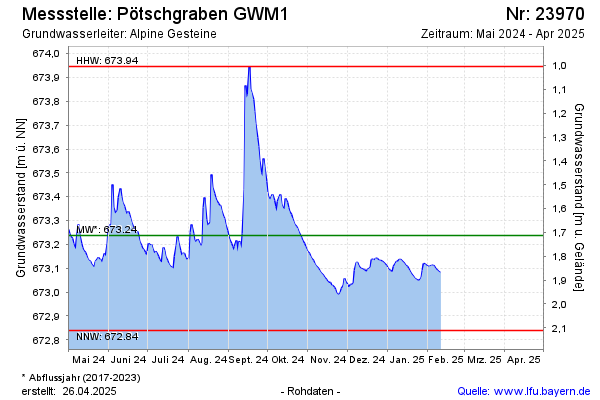
| Date | Groundwater level [m above sealevel] |
|---|---|
| 20.03.2026 | 673.30 |
| 19.03.2026 | 673.22 |
| 18.03.2026 | 673.21 |
| 17.03.2026 | 673.23 |
| 16.03.2026 | 673.27 |
| 15.03.2026 | 673.42 |
| 14.03.2026 | 673.55 |
| 13.03.2026 | 673.58 |