
- Start >
- Groundwater >
- Waterlevel of upper layer >
- Inn >
- PLIENING 556A >
- Chart of total period

Chart of total period PLIENING 556A
Groundwater levels of the total period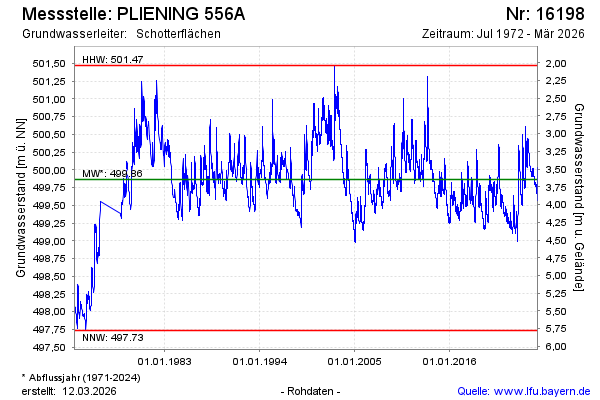
note
Die Messtelle musste 1977 verlegt werden.
Groundwater level [m above sealevel]: 499.55
Distance to surface [m]: 3.98
Last value from 25.04.2024 09:00
Ground level [m above sealevel]: 503.53
| Date | Groundwater level [m above sealevel] |
|---|---|
| 25.04.2024 | 499.55 |
| 24.04.2024 | 499.55 |
| 23.04.2024 | 499.55 |
| 22.04.2024 | 499.56 |
| 21.04.2024 | 499.56 |
| 20.04.2024 | 499.56 |
| 19.04.2024 | 499.57 |
| 18.04.2024 | 499.57 |
© Bayerisches Landesamt für Umwelt 2024