
- Start >
- Groundwater >
- Waterlevel of upper layer >
- Inn >
- Perach GWM2-HWS Weitbach >
- Chart of total period

Chart of total period Perach GWM2-HWS Weitbach
Groundwater levels of the total period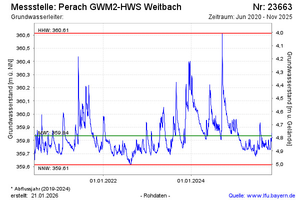
Groundwater level [m above sealevel]: 359.97
Distance to surface [m]: 4.65
Last value from 05.03.2024 12:24
Ground level [m above sealevel]: 364.62
| Date | Groundwater level [m above sealevel] |
|---|---|
| 05.03.2024 | 359.97 |
| 04.03.2024 | 359.97 |
| 03.03.2024 | 359.98 |
| 02.03.2024 | 359.99 |
| 01.03.2024 | 359.99 |
| 29.02.2024 | 359.99 |
| 28.02.2024 | 360.00 |
| 27.02.2024 | 360.00 |
© Bayerisches Landesamt für Umwelt 2024