
- Start >
- Groundwater >
- Waterlevel of upper layer >
- Inn >
- NIEDERACHEN 962 >
- Chart of total period

Chart of total period NIEDERACHEN 962
Groundwater levels of the total period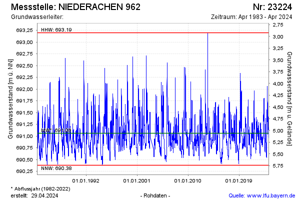
Groundwater level [m above sealevel]: 690.91
Distance to surface [m]: 5.21
Last value from 02.04.2026 06:00
Ground level [m above sealevel]: 696.12
| Date | Groundwater level [m above sealevel] |
|---|---|
| 02.04.2026 | 690.91 |
| 01.04.2026 | 690.91 |
| 31.03.2026 | 690.92 |
| 30.03.2026 | 690.93 |
| 29.03.2026 | 690.93 |
| 28.03.2026 | 690.94 |
| 27.03.2026 | 690.95 |
| 26.03.2026 | 690.97 |
© Bayerisches Landesamt für Umwelt 2026