
Chart of total period N8 - HWS Mörnbach
Groundwater level [m above sealevel]: 411,38
Distance to surface [m]: 2,95
Last value from 11.03.2026 13:00
Ground level [m above sealevel]: 414.33
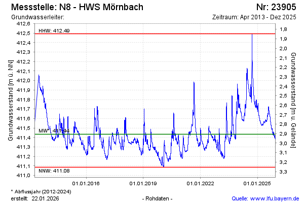
| Date | Groundwater level [m above sealevel] |
|---|---|
| 11.03.2026 | 411.38 |
| 10.03.2026 | 411.38 |
| 09.03.2026 | 411.39 |
| 08.03.2026 | 411.40 |
| 07.03.2026 | 411.41 |
| 06.03.2026 | 411.42 |
| 05.03.2026 | 411.44 |
| 04.03.2026 | 411.45 |