
- Start >
- Groundwater >
- Waterlevel of upper layer >
- Inn >
- N13 - HWS Mörnbach >
- Chart of total period

Chart of total period N13 - HWS Mörnbach
Groundwater levels of the total period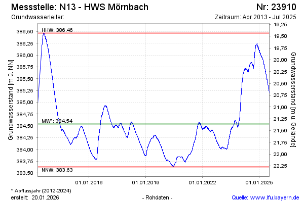
Groundwater level [m above sealevel]: 385.20
Distance to surface [m]: 20.70
Last value from 17.07.2025 12:00
Ground level [m above sealevel]: 405.90
| Date | Groundwater level [m above sealevel] |
|---|---|
| 17.07.2025 | 385.20 |
| 16.07.2025 | 385.21 |
| 15.07.2025 | 385.21 |
| 14.07.2025 | 385.21 |
| 13.07.2025 | 385.22 |
| 12.07.2025 | 385.23 |
| 11.07.2025 | 385.23 |
| 10.07.2025 | 385.23 |
© Bayerisches Landesamt für Umwelt 2026