
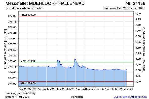
Current data MUEHLDORF HALLENBAD
Groundwater level [m above sealevel]: 374.61
Distance to surface [m]: 6.49
Last value from 13.07.2026 10:00
Ground level [m above sealevel]: 381.10
| Date | Groundwater level [m above sealevel] |
|---|---|
| 13.07.2026 | 374.61 |
| 12.07.2026 | 374.62 |
| 11.07.2026 | 374.63 |
| 10.07.2026 | 374.60 |
| 09.07.2026 | 374.61 |
| 08.07.2026 | 374.61 |
| 07.07.2026 | 374.62 |
| 06.07.2026 | 374.63 |