
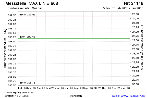
Current data MAX LINIE 608
note
Die Messstelle wird nicht mehr beobachtet.
Groundwater level [m above sealevel]: 396.96
Distance to surface [m]: 28.61
Last value from 16.04.2026 12:02
Ground level [m above sealevel]: 425.57
| Date | Groundwater level [m above sealevel] |
|---|---|
| 16.10.2025 | 397.52 |
| 22.04.2025 | 398.09 |
| 10.10.2024 | 397.97 |
| 18.04.2024 | 397.49 |
| 19.10.2023 | 396.60 |
| 19.04.2023 | 396.51 |
| 18.10.2022 | 396.30 |
| 12.04.2022 | 396.19 |