
- Start >
- Groundwater >
- Waterlevel of upper layer >
- Inn >
- LOHHOF 275A >
- Chart of total period

Chart of total period LOHHOF 275A
Groundwater levels of the total period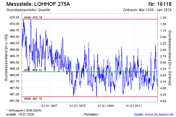
Groundwater level [m above sealevel]: 468.30
Distance to surface [m]: 3.19
Last value from 01.05.2024 09:00
Ground level [m above sealevel]: 471.49
| Date | Groundwater level [m above sealevel] |
|---|---|
| 01.05.2024 | 468.31 |
| 30.04.2024 | 468.31 |
| 29.04.2024 | 468.32 |
| 28.04.2024 | 468.33 |
| 27.04.2024 | 468.35 |
| 26.04.2024 | 468.36 |
| 25.04.2024 | 468.37 |
| 24.04.2024 | 468.38 |
© Bayerisches Landesamt für Umwelt 2024