
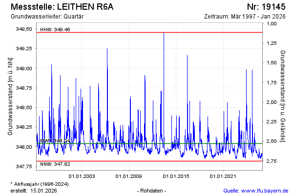
Chart of total period LEITHEN R6A
note
GW Messstelle im Grundnetz
Groundwater level [m above sealevel]: 347,82
Distance to surface [m]: 2,75
Last value from 22.07.2026 08:00
Ground level [m above sealevel]: 350.57
| Date | Groundwater level [m above sealevel] |
|---|---|
| 22.07.2026 | 347.82 |
| 21.07.2026 | 347.82 |
| 20.07.2026 | 347.83 |
| 19.07.2026 | 347.82 |
| 18.07.2026 | 347.81 |
| 17.07.2026 | 347.81 |
| 16.07.2026 | 347.81 |
| 15.07.2026 | 347.81 |