
- Start >
- Groundwater >
- Waterlevel of upper layer >
- Inn >
- KIRCHHEIM I 554 >
- Current data

Current data KIRCHHEIM I 554
Groundwater levels of the last 12 months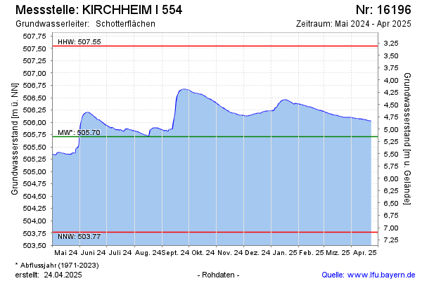
Groundwater level [m above sealevel]: 505.33
Distance to surface [m]: 5.53
Last value from 04.05.2024 09:00
Ground level [m above sealevel]: 510.86
| Date | Groundwater level [m above sealevel] |
|---|---|
| 04.05.2024 | 505.33 |
| 03.05.2024 | 505.34 |
| 02.05.2024 | 505.34 |
| 01.05.2024 | 505.35 |
| 30.04.2024 | 505.35 |
| 29.04.2024 | 505.36 |
| 28.04.2024 | 505.36 |
| 27.04.2024 | 505.37 |
© Bayerisches Landesamt für Umwelt 2024