
Current data Kalkofen 3A
Groundwater level [m above sealevel]: 734.36
Distance to surface [m]: 6.88
Last value from 16.06.2026 15:25
Ground level [m above sealevel]: 741.24
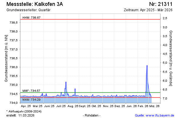
| Date | Groundwater level [m above sealevel] |
|---|---|
| 16.06.2026 | 734.35 |
| 15.06.2026 | 734.34 |
| 14.06.2026 | 734.36 |
| 13.06.2026 | 734.40 |
| 12.06.2026 | 734.33 |
| 11.06.2026 | 734.39 |
| 10.06.2026 | 734.38 |
| 09.06.2026 | 734.34 |