
- Start >
- Groundwater >
- Waterlevel of upper layer >
- Inn >
- Hochmutting Süd >
- Year chart of precipitation

Year chart of precipitation Hochmutting Süd
Groundwater levels of the last 12 months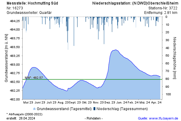
Groundwater level [m above sealevel]: 482,66
Distance to surface [m]: 8,49
Last value from 25.04.2024 10:00
Ground level [m above sealevel]: 491.15
© Bayerisches Landesamt für Umwelt 2024