

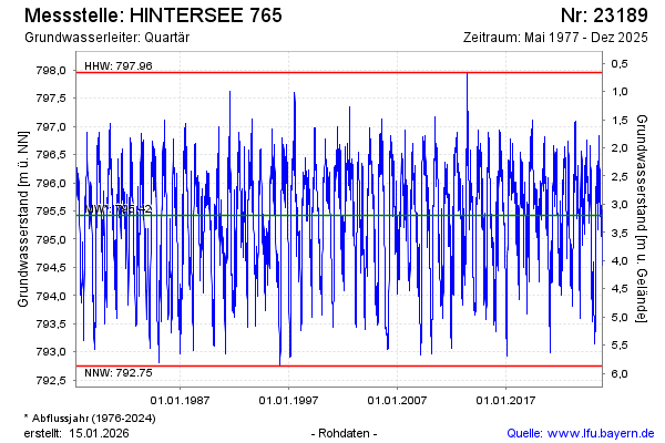
Chart of total period HINTERSEE 765
Groundwater level [m above sealevel]: 795,43
Distance to surface [m]: 3,19
Last value from 06.07.2026 08:35
Ground level [m above sealevel]: 798.62
| Date | Groundwater level [m above sealevel] |
|---|---|
| 06.07.2026 | 795.43 |
| 05.07.2026 | 795.49 |
| 04.07.2026 | 795.58 |
| 03.07.2026 | 795.64 |
| 02.07.2026 | 795.64 |
| 01.07.2026 | 795.58 |
| 30.06.2026 | 795.61 |
| 29.06.2026 | 795.65 |