
- Start >
- Groundwater >
- Waterlevel of upper layer >
- Inn >
- HEUFELD R 38 >
- Chart of total period

Chart of total period HEUFELD R 38
Groundwater levels of the total period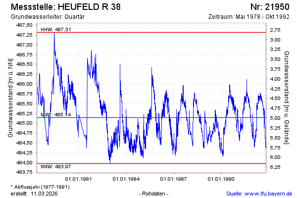
note
Die Messstelle wurde 2001 verfüllt !
Groundwater level [m above sealevel]: 484.40
Distance to surface [m]: 5.73
Last value from 31.10.1992 23:59
Ground level [m above sealevel]: 490.13
| Date | Groundwater level [m above sealevel] |
|---|---|
| 31.10.1992 | 484.39 |
| 29.10.1992 | 484.39 |
| 28.10.1992 | 484.44 |
| 27.10.1992 | 484.50 |
| 26.10.1992 | 484.48 |
| 23.10.1992 | 484.36 |
| 21.10.1992 | 484.37 |
| 20.10.1992 | 484.40 |
© Bayerisches Landesamt für Umwelt 2026