
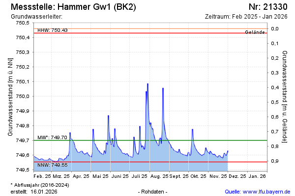
Current data Hammer Gw1 (BK2)
Groundwater level [m above sealevel]: 749.63
Distance to surface [m]: 0.83000000000004
Last value from 16.06.2026 12:30
Ground level [m above sealevel]: 750.46
| Date | Groundwater level [m above sealevel] |
|---|---|
| 16.06.2026 | 749.61 |
| 15.06.2026 | 749.62 |
| 14.06.2026 | 749.64 |
| 13.06.2026 | 749.67 |
| 12.06.2026 | 749.63 |
| 11.06.2026 | 749.67 |
| 10.06.2026 | 749.66 |
| 09.06.2026 | 749.59 |