
- Start >
- Groundwater >
- Waterlevel of upper layer >
- Inn >
- GWM Badeweiher Aspertsham >
- Chart of total period

Chart of total period GWM Badeweiher Aspertsham
Groundwater levels of the total period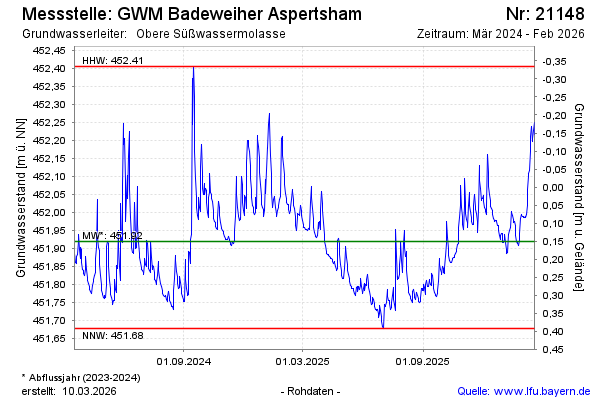
Groundwater level [m above sealevel]: 451.88
Distance to surface [m]: 0.19
Last value from 12.05.2026 10:03
Ground level [m above sealevel]: 452.07
| Date | Groundwater level [m above sealevel] |
|---|---|
| 12.05.2026 | 451.87 |
| 11.05.2026 | 451.84 |
| 10.05.2026 | 451.82 |
| 09.05.2026 | 451.83 |
| 08.05.2026 | 451.84 |
| 07.05.2026 | 451.86 |
| 06.05.2026 | 451.85 |
| 05.05.2026 | 451.84 |
© Bayerisches Landesamt für Umwelt 2026