
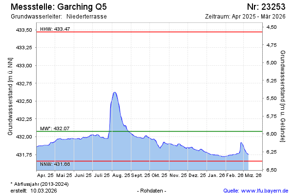
Current data Garching Q5
Groundwater level [m above sealevel]: 431.91
Distance to surface [m]: 6.13
Last value from 24.06.2026 09:00
Ground level [m above sealevel]: 438.04
| Date | Groundwater level [m above sealevel] |
|---|---|
| 26.06.2026 | 431.92 |
| 25.06.2026 | 431.91 |
| 24.06.2026 | 431.91 |
| 23.06.2026 | 431.91 |
| 22.06.2026 | 431.91 |
| 21.06.2026 | 431.91 |
| 20.06.2026 | 431.90 |
| 19.06.2026 | 431.91 |